-
About
- About Listly
- Community & Support
- Howto
- Chrome Extension
- Bookmarklet
- WordPress Plugin
- Listly Premium
- Privacy
- Terms
- DMCA Copyright
- © 2010-2025 Boomy Labs

 Joy Morey
Listly by Joy Morey
Want to know more about the Geography of the United States, Mexico, Canada and the Caribbean? Click on some of the following links to learn about landforms!
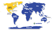
Mountains of south-central Alaska that extend from the Alaska Peninsula to the border of the Yukon Territory, Canada. The highest point in North America, Mt. McKinley , 20,320 ft. (6,194 m) is located here. Significant Appalachian ranges include: The Cumberland Mts. in Tennessee The Blue Ridge Mts.
Although land only makes up one fourth of the earth's surface, we tend to know it better as it is the part we live in. There are many classifications of land forms, depending on what kind of map a person is looking at.

Uploaded by TheChamberlinChannel on 2014-07-18.
Here are 10 surprising geological facts about the United States. We're all well aware that the US is filled with mountains, canyons, lakes, and waterfalls, but Mother Nature still has a few, astonishing wonders up her sleeve. Here are 10 surprising facts about the United States. Number 10.
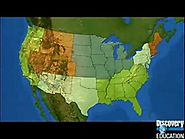
A brief educational video on the geography of the United States.
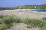
DEPOSITIONAL LANDFORMS built up by movement of material, usually sediment. Alluvial Fan -Where sediment spills from hills into piles on plains. Bajada -Apron of debris built of many alluvial fans. Bar -Sediment piled across the mouth of a river or bay. Barrier Island -Long sandy bar that guards the coast.

wetland A wetland is an area of land that is often wet; the soil in wetlands are often low in oxygen. Wetland plants are adapted to life in wet soil. There are many types of wetlands, including: swamp, slough, fen, bog, marsh, moor, muskeg, peatland, bottomland, delmarva, mire, wet meadow, riparian, etc.
