 mirsinnov
Are you looking for aerial photography service? We are a team of young multi-skilled individuals based in Singapore with key specializations in extreme close proximity aerial filming, drone aerial photography, drone aerial video & real estate photography.
Innovative leader in aerial photography services based in Singapore.Call us now on +65 62456863 to get aerial photographic services at affordable rate.
We provide Professional drone construction photography Services for Architecture, Engineering, and Construction.
Track, map, survey, inspect, and manage your worksite projects with us. Construction drone services and aerial data is the innovative solution to deliver sophisticated analytics or provide a visual progress report to stakeholders. We have worked on thousands of construction sites nationwide and holds all the necessary insurance to perform the job safely and under compliance.
The five steps to getting drones on your construction site
Get Some Promo Shots (Semi-Annually)
Find one of your projects that is almost complete, or was recently completed, and hire a drone pilot to film it. It’s an easy, low-pressure way to test out the process and get familiar with the product. You’ll also get some good marketing material out of it. You’ll likely see the immediate value, and wish you had some before images to cut in with the final build shots.
Capture Major Milestones (Bi-Monthly)
Once you see the results of your first drone experience, you might be tempted to go out, get licensed, and buy a drone all in one day. We’d recommend taking it a bit slower. Use one of the drone providers in our drone resources section to hire a freelance pilot, and have them fly your site to capture aerials at major intervals. This’ll give you a chance to get more familiar with the advantages of aerial photography, and see how you want to use it for your projects.
Complete a Pay Application with Drone Footage (Monthly)
With the aerial footage of your major milestones in hand, go back to some old pay apps and test out how you could use the images to improve your pay applications. With the proper tools, you’ll see how much simpler the billing process can be and likely find progress that you neglected to bill for. Then, go ahead and use aerial images to supplement your next pay app. This is where most firms find the largest immediate payoff from using drones, and where the transition from freelance pilot to in-house pilot usually begins.
Fly on Fridays (Weekly)
As you get more comfortable with invoicing off of aerial images, you will naturally start finding more opportunities to put them into your workflow. Try getting in the habit of flying weekly, ideally on Fridays, so you can capture the work for the week. It’s at this stage we recommend purchasing your own drone and getting a member of your staff licensed to fly. You should also choose software to manage the large amount of data you will be capturing.
Get Ad-Hoc Updates and Real Change Progress (Daily)
At this point, you can fully integrate drones into your daily workflow. You should absolutely have someone onsite doing your drone flights, as a freelancer will no longer be a cost-effective solution. You also will need software that can manage the large amount of data you’re collecting. However, at this stage, you will receive a detailed level of insights that simply has never been available to construction firms before.
Drone photography is the fastest growing area of image capturing. From rules and regulations to the best drone to use, our guide has all the info you need.
Commercial UAV Inspection Services
Data insights can now take flight with the power of connected data and drones.
DRONE AND PILOT
• Specific drone utilized and tailored to your industry segment
• Airspace management and coordination with all current required airspace regulations
• Licensed, certified and trained pilots globally
INSPECTOR APP
• Pictures, annotation and mark-up capabilities
• Command and control onboard sensors
• Mission planning, data tagging, photo classification
WEB PORTAL
• Enhanced data visualization and reporting
• Searchable imagery cataloged to recall when you need it
• Standardized data stored and tagged to each asset for tracking over time
• Optimized operations
Construction Site Mapping
The 3D model is one of the best aids in visualising the three dimensionalities of an object or a building of interest as it provides a clear perception of size and depth. It is a perfect tool for project showcase, presentation, and interactive web design.
Drone Volume Calculation
Drone volume calculation would enable the measurement of the stockpile with high accuracy and precision. The drone, fitted with RTK abilities, would be used to capture the photographs of the stockpile.
Through the use of an RTK drone, a pin-point accuracy of the latitude and longitude coordinates can be assured. The imagery will then be processed by using specialised software to create a point-cloud of all the measurements.
Types of Mapping
Digital Orthophoto Map (DOM) is a raster image generated by merging orthophotos such as an aerial or satellite photograph. As the images are corrected for perspective error, it would appear that they have been taken from vertically above, at an infinite distance.
Digital Terrain Model (DTM) provides a bare earth representation of terrain or surface topography. It is useful for the design of railroad, highway, and transmission cable as it consists of calculation of area, volume and slope for various project.
Digital Surface Model (DSM) refers to a ground elevation model that includes object heights on the surface such as buildings, bridges, and trees. It can be used to monitor the urban plan and growth of the forest.
UAVs can reduce the need for people to work at height and in confined spaces, enabling a safe first audit of the tank inspection which is more precise than manual inspection.
Customized micro/mini size drones with 4K recording capabilities
Customized drones with variable payload solutions
The aerial drones we have are not only for work, it is also our passion. Many a time during our off days or even on vacations, we would most likely also be out flying, creating beautiful aerial photography & video work.
The amount of time we spend flying translates to us being very experienced & smooth drone operators, regardless of any project you may have in mind, we are most confident to be able to provide a professional solution for you.
Our rates for aerial photography, drone aerial video & real estate photography are affordable & value for money.
Close proximity flying is required & useful in an array of situations, below are just a few examples:
Car Chase
Boat Chase
Subject Tracking
Action Scenes
Aerial Inspection
CAAS Licensed Drone Operator
We also adhere strictly to the country’s laws & regulations governing drone flights, as such we are also a fully licensed drone operator, registered with CAAS (Civil Aviation Authority Of Singapore). As with every job that is tasked upon us, we will also apply for the required activity permit & obtain permission from the relevant authorities before the job is carried out, We are professional, experienced & committed to produce results for any assignment.
FIVE Drone Cinematic Shooting Techniques
(1) Aerial Pan Shot
Pan shot is a drone photography shot method which the camera is made to pivot horizontally left or right (about its vertical axis) while filming. Pans are always described in terms of “panning left” or “panning right” (Source: Wikipedia). To take an interesting view, artists prefer to use the “hover mode” which maintain the stability while taking shots. One trick to get a perfect video, simply rotate the drone across the landscape you want to shoot.
(2) Tracking Shot
Tracking shot is a drone photography shot method in which the camera moves alongside or parallel to its subject while filming. Shots taken from moving vehicles that run parallel to another moving object are also referred to as tracking or traveling shots. In another word, tracking shots often “follow” a subject while it is in motion. (Source: Wikipedia)
(3) Pedestal Shot
Pedestal shot are basically taking shots by only moving the drone without changing the position of camera. This type of shots is usually used on buildings, statues, monuments, views of sea and even views above the clouds. This method is easy and simple as one only need to control the altitude by going up and down (two directions), without worrying the movement of camera.
(4) Fly Over Technique
Shots that you always seen from TV commercial to music videos all the time is using this flying over method by drone photography. A landscape or subject is focused by the whole camera from a certain distance while moving continuously towards it until it covers the whole landscape and passes it from above. This can always be seen shooting the stadium for football cup or indoor concert and festival.
(5) Reveal Shot
The classic motion pictures that you always see during the start of a movie featuring the intro of a specific scene. This is a method where you initiate your drone at a spot out of the view of the subject then slowly move in the view of the subject. It is as simple as this, but this certainly create memorable scene effect.
Services We Provide
Drone Aerial Photography & Drone Aerial Video Services
Aerial Inspection Services (Chimney, Power Line, Flare Inspection etc) & Surveillance
Drone Mapping , Drone 3D Modeling, Drone Photogrammetry & 360 Virtual Reality Tours
Architecture, Real Estate, Landscape & Commercial Photography
Drone Light Show Services
And much more! Drop us an enquiry to discuss!
*What is aerial photography?
*Aerial photography is the taking of photographs of an aircraft or other flying object. Platforms for aerial photography include fixed-wing aircraft, helicopters, unmanned aerial vehicles, balloons, blimps and dirigibles, rockets, pigeons, kites, parachutes, stand-alone telescoping and vehicle-mounted poles.
*What is aerial photography used for?
*
Photogrammetry and photo/image interpretation have developed as two separate but connected sciences as a result of these two diverse applications. Photogrammetry refers to the science and technology of using aerial pictures to make accurate measurements. The concept of photogrammetry allows for precise measurements of length, width, and height from such photos. As a result, they are used to create and update topographic maps as a data source.
Cartography, land use planning, archaeology, film production, environmental studies, espionage, commercial advertising, conveyancing, and other industries all employ aerial photography. Aerial photograph taken from an airplane of a neighborhood.
Aerial photographs are classified into three types based on the position of the camera's axis: (i) vertical photographs, (ii) low oblique photographs, and (iii) high oblique photographs.
*Importance of aerial photography
*
Due to its ability to distinguish site locations, record and monitor changes in their environments over time, and even find subterranean structures using topsoil characteristics or stereoscopic inspection of photos, aerial photography is commonly utilized in archaeological prospection.
Nowadays, getting a beautiful aerial shot requires more than just deciding which drones or aircraft to employ. Composition, technique, and timing are all crucial factors in capturing aerial images that stand out.
*Inspiration and Tips for Aerial Photography
*
The majority of aerial photography articles on the internet focus on gear and technique, such as camera settings.
Shoot in the morning or evening.
The angle of the sun during outdoor shooting has a significant impact on your images. Aerial photography isn't any different. In fact, during aerial shooting, the sun's angle is considerably more critical. Depending on the time of day, your subjects will appear significantly different from the above.
The greatest times to shoot are early in the morning and late in the evening, when you'll get more dramatic shadows and beautiful gold-tinged colors. You'll have a better chance of catching interesting subjects and spectacular views if you schedule your shot around the start or finish of the day.
*Look for people.
*People have an innate ability to attract attention. They ensure that your photo has a point of interest that viewers can focus on and connect with, even if they're only a little element of the composition. They can provide emotional depth to images as well as a feeling of scale, demonstrating how big a landscape actually is.
*Keep your composition clean and simple.
*
When your aerial view is densely packed with data, it can be difficult to limit your snapshot down to certain features. If you try to catch too much, your viewers won't be able to focus on anything. They'll become lost in the scenery, and your image will be forgotten.
Your readers will be able to appreciate the scene more if you keep your image clean and basic. You may have to leave out things you enjoy, but instead of cramming everything into one shot, take many photographs of each topic.
This is crucial for drone videographer.
Drone "No-Fly" zones surround Seletar and Changi airports in Singapore. This restricted area encompasses the majority of Singapore's eastern and northern regions.
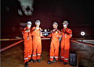
Businesses are responding to changing circumstances and the demand for safe, adaptable, and efficient solutions. Remote inspection may be performed by our worldwide team of inspectors and auditors to offer you the same level of technical knowledge and real-time information.
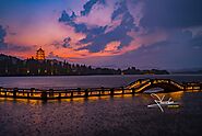
Aerial pictures may be used to show off beautiful landscapes, buildings, and more.
Advantages of aerial photography.
Drones possess a number of advantages. Independence and flexibility are the most important factors. Feel like taking some aerial shots because there's some lovely evening light outside your window? It's no problem; simply grab the drone and take off.