 cassandra-koontz-scaf
This is a list of GIS, RS, and geospatial data sources, training materials, and how-to's that I've found useful for geospatial analysis.
Learn the basics of using ArcGIS Earth in this webinar. You can also download the lecture slides for Introduction to ArcGIS Earth. For more information on ArcGIS Earth please consider our 1/2 day Introduction to ArcGIS Earth classes coming soon.
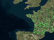
The IRHUM (Isotopic Reconstruction of Human Migration) database is a web platform to access, explore and map isotope data to investigate migration. It is maintained at the Research School of Earth Sciences, ANU. Details about the data and their source is located in the individual layer files. Always cite the original source of the data.
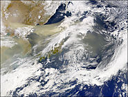
The understanding of mineral dust aerosols and their impacts on climate depends on the ability of regional and global climate models in reproducing their composition, size and shape.
This has motivated a number of field experiments which have been conducted in the last few years, both over source and transport regions.